Update!! The links to the finished report can be found below…
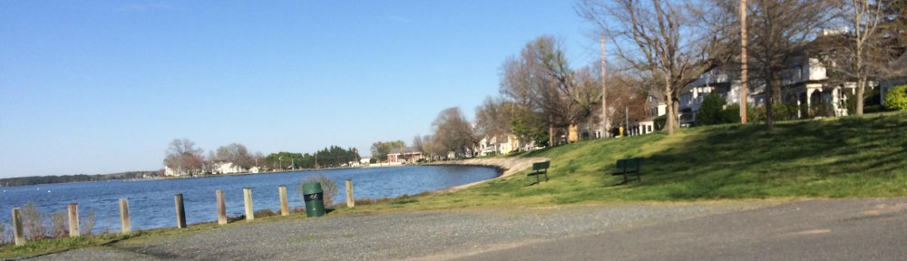
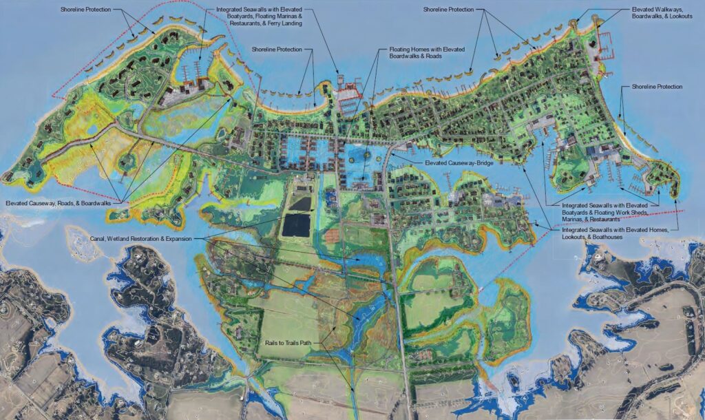
The Oxford 2100 Visioning Project was a strategic planning exercise to first envision the Town of Oxford having successfully met predicted sea level rise and then to determine the necessary infrastructure steps that would have taken place in order to have achieved this vision, including a timeline for these steps.
This project was developed through grant funding from the Maryland Department of Natural Resources Chesapeake and Coastal Service program with the following identified Task Outcome:
“A series of designs will be created that envision the Town of Oxford in the year 2100 utilizing adaptation and mitigation practices that account for rising sea levels. A list of the adaptations and infrastructure improvements will be developed along with their intended construction date. The Town will at the conclusion of the project have a report that will enable them to draft an 80-year capital improvement plan; to prioritize infrastructure needs based on urgency and feasibility; and to review current planning regulations in order to implement limits that will meet the lifetime of proposed new construction.”
The initial phase of the project included University of Maryland Landscape Architecture students through the PALS program, who following a visit and investigation developed individual concepts of what they thought Oxford would look like in 2100. These concepts will be included in the final product.
The second phase of the project was implemented by Preservation Green LLC., in coordination with GMB Engineering. Following award to the winning bidder, the project involved incorporation of the viable components of the students work into a final vision for the town, prioritization of the infrastructure needs to achieve the vision, and a proposed timeline of infrastructure improvements over an 80 year span of time.
October 24, 2023: The Final Oxford 2100 Visioning Report was presented to the Commissioners of Oxford at their regular meeting on October 24, 2023. A public presentation providing insight to this project will be held at the Oxford Community Center in the spring of 2024. Click on the links below for the complete report.
Oxford 2100 – A Strategic Resiliency Plan – Volume I
Oxford 2100 – A Strategic Vision – Volume II
Oxford 2100 – Univ of MD PALS Student Visions – Volume III
June 10, 2023 A public workshop held at the OCC gave residents the opportunity to review the overall Concept Vision, hear from the design/engineering team, Preservation Green LLC and GMB LLC, and to provide input regarding the work.
Oxford-Public-Presentation-06.15.23
May 1, 2023 Preservation Green LLC, in coordination with GMB LLC, was contracted to develop the Oxford 2100 Strategic Vision Report, using the UMD Student designs as inspiration. Their task is summarized below:
A series of designs will be created that envision the Town of Oxford in the year 2100 utilizing adaptation and mitigation practices that account for rising sea levels. A list of adaptations and infrastructure improvements will be developed along with their intended construction date. The Town will at the conclusion of the project have a report that will enable them to draft a 80-year capital improvement plan; to prioritize infrastructure needs based on urgency and feasibility; and to review current planning regulations in order to implement limits that will meet the lifetime of proposed new construction.
Fall of 2021 As the first phase of the Oxford 2100 Visioning Project, with the help of the UMD PALS Program, ten Landscape Architect students developed story boards for their vision of a successful Oxford thriving in the year 2100. UMD LA Student Process
February 2020 the town successfully applied to the Maryland Chesapeake and Coastal Grants Gateway and was awarded funding to support a comprehensive planning effort to help address the flood risks associated with climate change.
Please visit https://coast.noaa.gov/slr/ where you will find a sea level rise viewer you can use to view the potential impact of sea level rise in your area.